
Twenty-one months into COVID hibernation, we often wonder when we’ll see our kids again. They reside on the other side of the border, a thin imaginary political line of separation. While thinking of that, it dawned on me that we do share some common geography.
Living near the shore of Lake Michigan, outside of Chicago, we share the same water basin as those kids who live in Toronto, on the shore of Lake Ontario. So while we may be some 600 miles distant, I take some comfort knowing that we drink from the same trough.

I am reminded of that wonderful book, Paddle-to-the-Sea by Holling Clancy Holling. A young boy dreamed one late winter of sending his small carved canoe “Paddle Person” from the melting ice of Lake Nipigon down into the Great Lakes, and ultimately to emerge in the Atlantic. It’s an excellent illustration of our connectedness by way of the water.

Less well known is our connection due to the Niagara Escarpment. As a boy raised in Southern Ontario, I have always taken the escarpment as one of those unique wonders of Canadian geology. The escarpment appears–and I will elaborate on that in a moment–to originate at the Niagara Falls, the escarpment’s namesake. Being some 170 feet high, the Falls are an incredible sight of raw nature, and have attracted millions over the years to view them, and feel the mist on their cheeks. They drain Lake Erie, and feed Lake Ontario. Back to our young boy, his Paddle Person will plummet over those falls in the story.

What any Ontarian knows is the migration of the escarpment west to Halton County where it turns north, moling through the terrain, eventually emerging on the Bruce Peninsula, which forms the western shore of Georgian Bay. At the northern point, Tobermory, the escarpment slips under water and emerges at Manitoulin Island near Georgian’s north shore. For Canadians, myself included, the escarpment ended there.

Imagine my surprise a few years ago when a friend in Green Bay Wisconsin pointed out that the Niagara Escarpment actually formed Green Bay itself, on the northwestern shore of Lake Michigan. Who knew? Our public education system failed to make that clear, decades ago. Let me just add, that as of thirty years ago, living in Toronto, I had no idea even where Green Bay was. My ignorance of Great Lake geography was woeful. The escarpment arcs in a southwesterly direction from Sault Ste. Marie, and forms a ridge that descends as far south as Appleton in northeast Wisconsin.
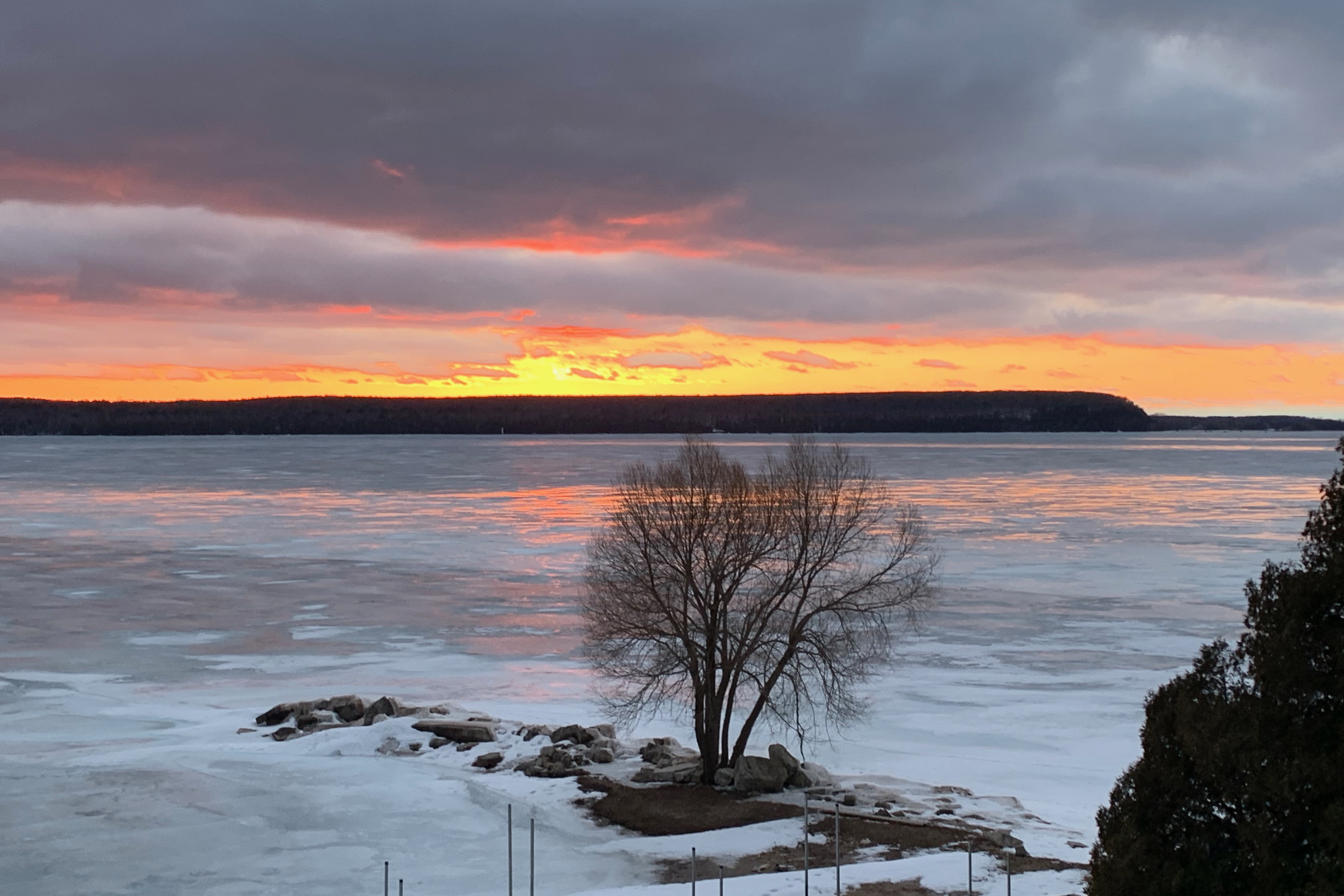
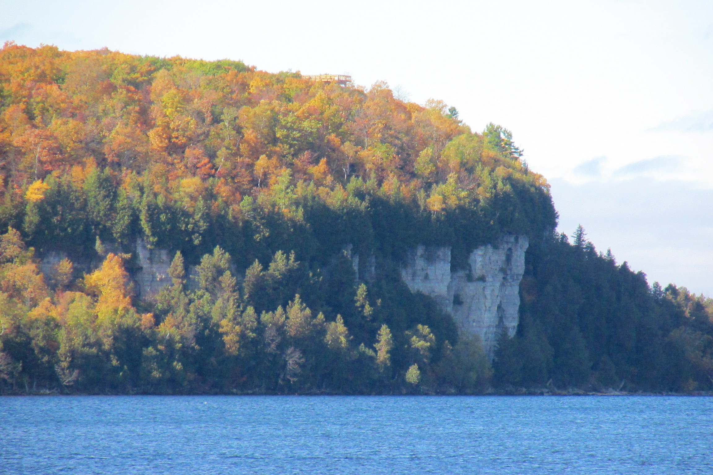
Only then did I appreciate the true size and dimension of this iconic limestone ridge. As a frequent visitor to Door County, Wisconsin, I marvel at the escarpment’s height and color. Well I should, as The Door owes its existence to the rugged cliff. The county’s maximum height is around 150 feet above Green Bay, close to that of Niagara Falls. At hundreds of sites along its coast, viewers can see the craggy cliffs that jut out of the waters. Inland, the roads nudge up against the towering limestone and dolomite rocks comprising thousands of distinguishable layers of sea floor, exposed to the air after hiding nearly 400 million years underground.

How did that happen? What made the pre-historic promontory raise its head?
The escarpment’s genesis is a long story told well in a short paragraph. Over a period of some 24 million years, during the Silurian age, an ancient sea was the home of jawed and bony fish and arthropods. They lived, died, and floated to the bottom to be pressed into limestone for the next 400 million years. You can see the remains of these creatures in the cliffs as long flat layers of cream-to-gold colored crumbling rock.

For your confirmation, the Jurassic period was only 200 million years ago. During the last ice age, some 20,000 years ago, the region surrounding the Great Lakes was submerged under a two-mile thick layer of ice. The weight of the ice pack actually depressed the land beneath it. When the ice melted, the weight was removed, and the land popped back up. The melt water helped dissolve much of the outcropping, and the escarpment was revealed. The process is called post glacial rebounding, and it continues even today.

Door County is the beneficiary of this geological epiphany. It is sandwiched between the temperature-moderating waters of Lake Michigan and Green Bay. The 40-mile spit of land is ideal for growing grapes, cherries and apples. The bi-products are wine, pie and cider. This agriculture is very similar to the escarpment in the Niagara Peninsula which also flourishes with similar viticulture and orchards.

We visit Door frequently, and as I stand on the shoreline of Lake Michigan, I think that as far away as Ontario may be, the water, and the cliffs connect us. Living in the Great Lakes region is a wonderfully inclusive thing, and the little Paddle Man proves it.
Thanks for reading! I hope that COVID has not prevented you from seeing your family, but hopefully you have mutual reference points, a star, a TV show, a sports team, perhaps a song that brings you closer together.
Paddle-To-The-Sea was written and first published in 1941. Beautifully written and exquisitely illustrated, its ISBN is 0-395-29203-4.
